WPC: Mother Thames


With so many amazing places to choose from where I have lived, at first it seemed difficult to pick a particular one.  But then I thought about my own heritage and what that means to me.  There’s no shortage of British heraldic symbols, but for me personally it has to be the Thames.  That river has literally and figuratively run through my life, as a child and young adult when I lived in London, and now whenever I have the opportunity to return.  Here are a few favourite pictures of familiar and perhaps less familiar portions, and Mother Thames, m’dear, I’ll see you next month!

https://dailypost.wordpress.com/photo-challenges/heritage/

Travel Theme: Numbers


I struggled with this week’s travel theme on “numbers”.  I didn’t have photographs or stories that I could recall.  However, I do love being impressed by the sheer number of things like sheep, or horses or monkeys.  So here are some crowd photos of  new animals friends met along the way:

101_0468
Fluffy clouds with fluffy sheep taken during the lambing season on the Ridgeway in the South of England.

A field full of horses came over to greet us

A field full of horses came over to greet us!

..and as bucolic as the sheep country is, horses are so much more fascinating with their welcoming curiosity.

DSC_0106
And finally, feeding time at the Swayambhuneth Temple, Kathmandu. Its called monkey temple for a reason, and you really don’t want to get in their way!

Thames Path: Day 3: London Bridge to Lambeth Bridge


London Bridge –– Southwark –Bermondsey  – South Bank – Waterloo- Westminster – Lambeth

riverthames2

River

If day one and day two were about a London riverside in development, day three was about a riverside that belongs to tourists, and the day started as it meant to go on with at least five different “river fun runs” underway. It didn’t help that it was a Sunday either. Crowds of tourists of all nationalities, strings and strings of riverside runners, and hustle and bustle. This wasn’t the Thames that we saw the day before. It took some negotiation to make our way along the riverside at this point. So many runners and tourists!

Hays Galleria

Exiting London Bridge station takes you directly into Hays Galleria, a large shopping center for tourists, mostly.

London Bridge

The London Bridge. Not very spectacular, is it? However there are many other much more impressive bridges all within a short distance of one another along this stretch of the Thames

Southwark Cathedral

Southwark Cathedral is the first major point of interest after you cross London Bridge. Parts of it date back to the 12th century and its well worth a visit if you have time. We didn’t….to busy dodging all the pesky joggers!

Like Greenwich, Southwark is steeped in history and you could easily spend half a day looking around. We hustled past the second of the historic ships that weekend. First the Cutty Sark in Greenwich, and here the Golden Hind.

Golden Hind

Passing Sir Francis Drake’s Golden Hind….past more of those joggers….

Southwark Bridge

Southwark Bridge with St Paul’s Cathedral in the background

DSC00572

Every inch of the city seemed alive in this section of town on a Sunday. Even the banks of the Thames, exposed at low tide, were covered in people. This crowd seemed to be “mudlarking” (searching through the mud for buried treasures.)

DSC00573

Further down the bank at Southwark is the Globe Theatre, a marvelous reconstruction of Shakespeare’s original Globe Theatre. One of these days I would love to see a performance there.

Millennium Bridge

A little further along from the Globe Theatre, the Millennium Bridge comes into view. Built in 2000 as the name suggests, this pedestrian bridge goes from the South Bank to the heart of the city and St Paul’s Cathedral

Millennium Bridge

Another diversion….had to cross the Millennium Bridge as I had never done it before. Great view down the Thames!

DSC00578

Looking back to Tower Bridge

DSC00579

Yep…yet more people. Millennium Bridge was packed. That’s what you get for going out on a Sunday!

DSC00580

Back on the South Bank heading towards Waterloo

DSC00584

Around the South Bank there are so many activities going on. This is the skateboarding park under the bridge

DSC00585

At the Royal Festival Hall. London Eye coming up in the distance

DSC00587

Street entertainers galore. These guys were doing a trick bicycle routine opposite the houses of parliament. But there were also singers, mime artists and jugglers….tourist heaven!

DSC00588

Close up on the London Eye

Houses of Parliament

A better view of the Houses of Parliament

DSC00592

Finally as we passed under Lambeth Bridge, a view of Lambeth Palace, home to the Archbishop of Canterbury and the end to the day’s excursion

We ended Day 3 in the area where tourist London also drops off. Further down the river, away from the main attractions, there will still be crowded riverside days at weekends, but it will mostly be Londoners, not tourists, that we will come across. However, when we pick the trail again from Lambeth Bridge, I imagine it won’t be until 2015. You never know, but I don’t think I can make it back to the UK next year, but I look forward to picking up the trail again…. watch this space!

Thames Path: Day 2: Greenwich to London Bridge


Greenwich – Deptford – Surrey Docks – Butlers Wharf – Tower Bridge – London Bridge

riverthames2
Day two picked up where we left off at the Cutty Sark near Greenwich Pier. There’s so much to see and do in Greenwich, and its hard to walk through London and not stop at 101 different worthy distractions. The previous day’s planned distance was reduced considerably in reality, as it simply too much fun to stop and look at everything. It quickly became clear that the London section of the walk was going to be more about exploring riverside activities than truly hiking away the miles, which was just fine with me.

 Royal Observatory Greenwich

The Royal Observatory Greenwich — home of Greenwich Mean Time (GMT) — only got a fleeting glance from us….

So, before we got very far along the Greenwich riverbank we stopped and explored the Greenwich Foot Tunnel that takes pedestrians underneath the Thames to the opposite bank.  Its a pretty cool experience and tiring too if you decide to take the stairs rather the lift shaft.

Greenwich Foot Tunnel

Looking back at the Cutty Sark as we headed westward down the river. The dome on the right is the entrance to the Greenwich Foot Tunnel on the South bank. (There’s a matching dome on the North Bank too.)

greenwich foot tunnel

Inside the Greenwich Foot Tunnel. Originally built as a pedestrian shortcut for workers over 100 years ago, its now a unique way to cross the Thames

As we were committed to the South Bank, we crossed back again and re-commenced our journey westward.  Deptford came up on us quickly.  Its a less developed, neglected part of the city, and the path took us away from the riverside and into 1960’s urban sprawl.

DSC00538

Riverside signage in Deptford.  A stark contrast to earlier signs along the Thames…

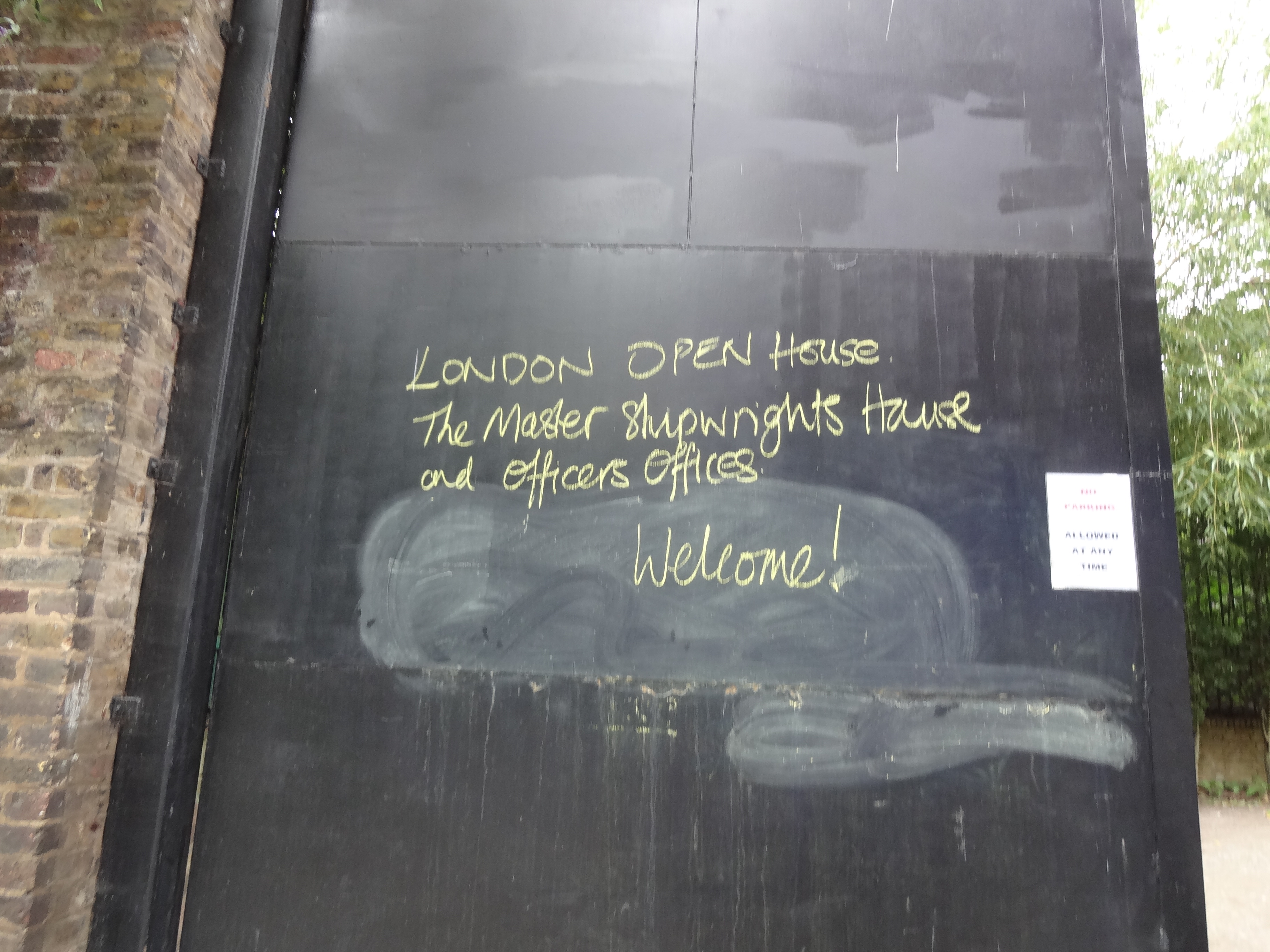
Although our walk took us down past some less attractive areas of town,  Deptford isn’t without it history or charms. It was also a Saturday, and the first day of the annual London Open House weekend, which I learnt meant that participating private residences or places of interest not normally open to the public were opening their doors so the likes of us could come and have a quick poke around. I had forgotten all about it, but as we walked down the back streets of Deptford, this gate beckoned us forth:

DSC00534

Normally closed to the public, the current resident of The Master Shipwrights House had opened his doors to anyone wishing to take a look around…

DSC00531

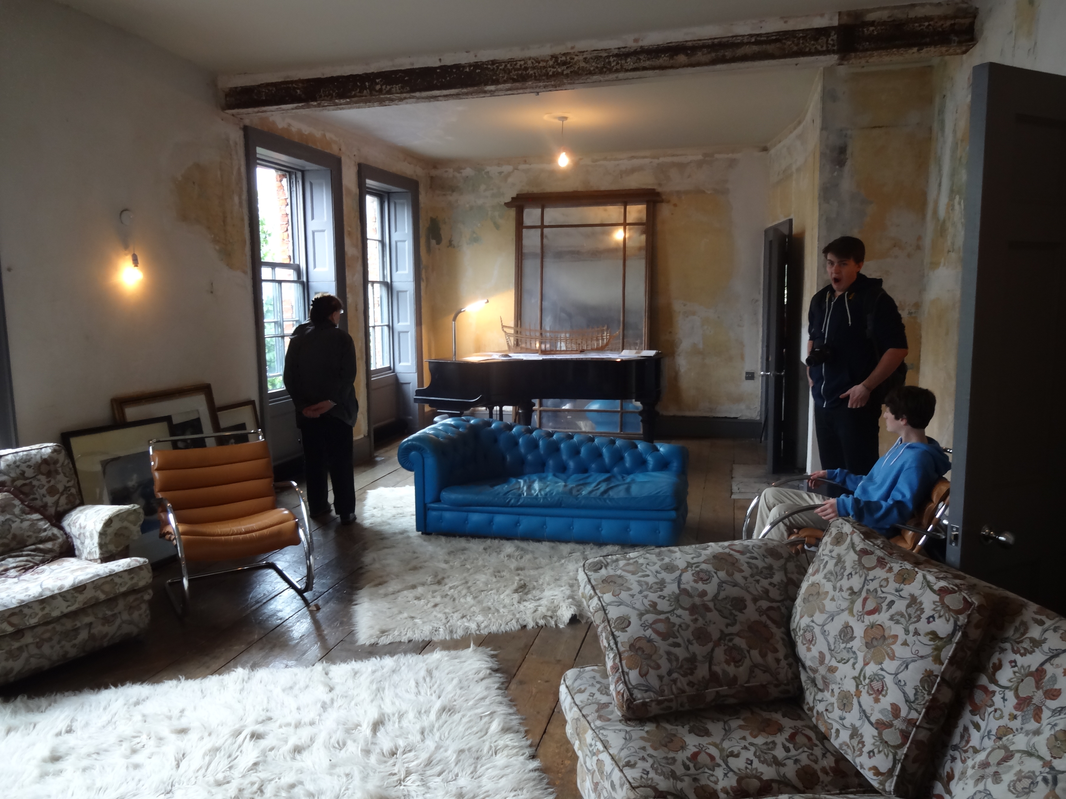
…so we took time out to do so.  It had attracted quite a large crowd of people and we all wandered around his home that was a mixture of history and every day living. I think the boys enjoyed it despite Latham’s yawn!

DSC00532

Obviously the house was in need of repairs, but historical upgrades are expensive and funds clearly weren’t there. But the house was sound and they had used the exposed walls and floorboards as part of the integral design. Interesting.

DSC00525

Outside they had used the garden’s riverside frontage to invite local historical societies and interest groups to give talks on various subjects….

DSC00528

…including a display of different salvaged treasures from the Thames, I think.

We spent a good hour in there, but eventually returned to the riverside trail, heading westward towards a series of quays.  If yesterday was about old industrial sites meeting new modern trendy London, today was about the quay.  Small marinas and quays were strung out in successions for the next couple of miles.

DSC00544

Crossing one of the many quays in the area.

The last one along this stretch was Surrey Quay, which unexpectedly hosted an organic garden and petting zoo, which seemed like a pleasant place to stop and grab some lunch. They are all set up for toddlers and finger food, but the adult organic restaurant was very good and we enjoyed the animals too!  An unexpected find in London!Surrey Docks Farm

DSC00549

Surrey Docks Farm has its ducks all in a row!

DSC00548

DSC00558

DSC00520

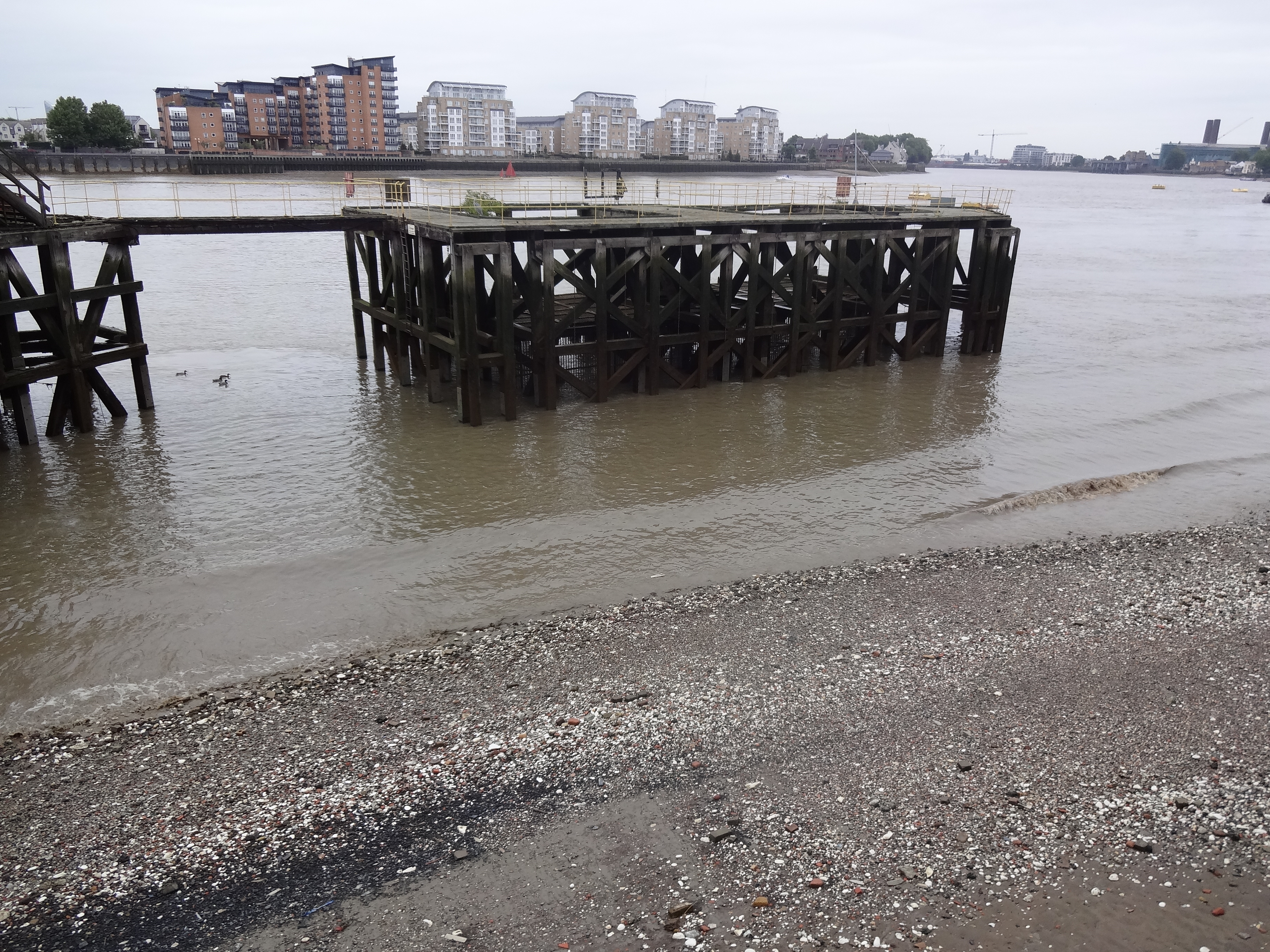
One of many lonely, crumbling jetties still standing….

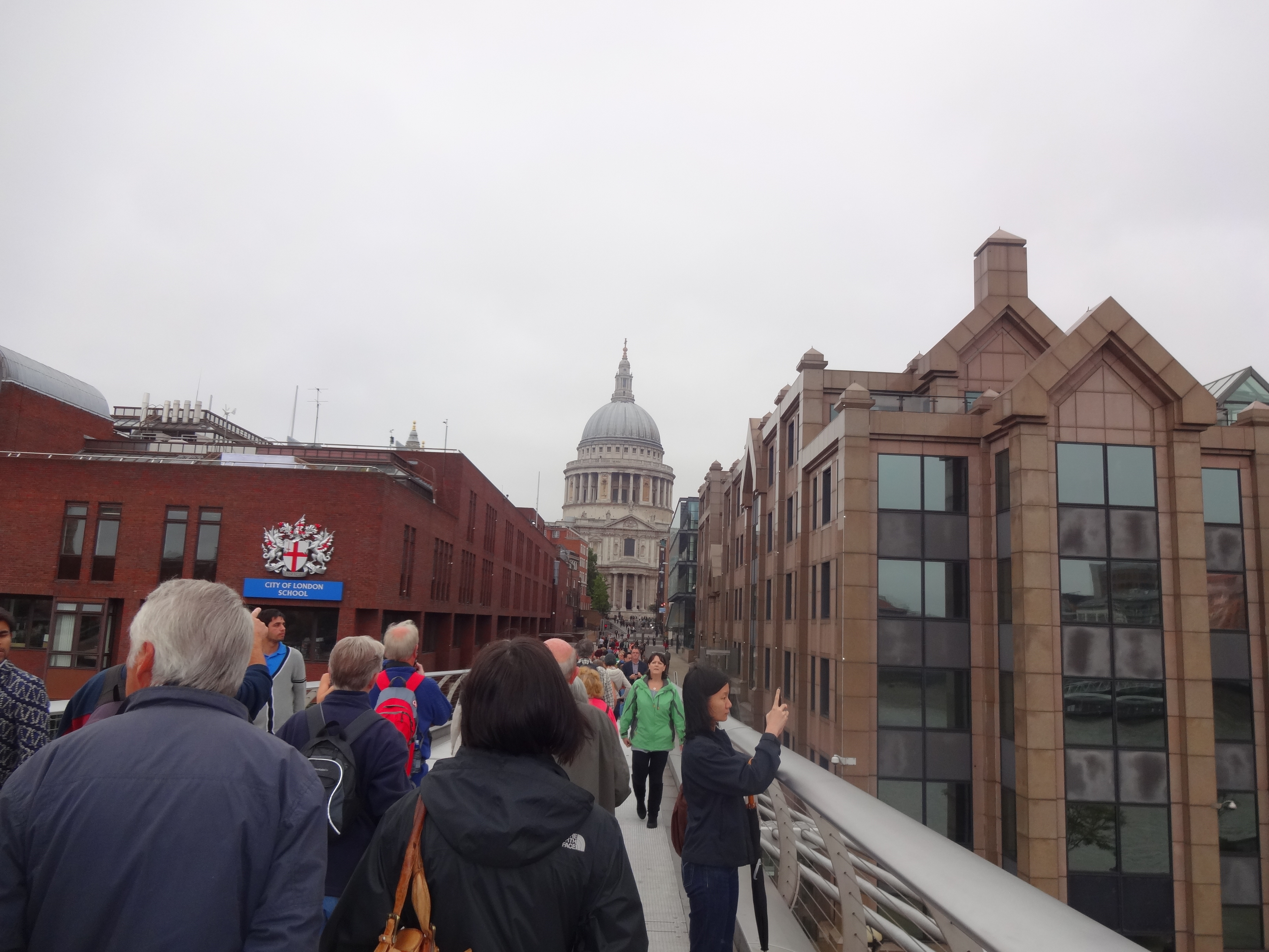
The rest of the day’s walk took us past the start of some upmarket housing developments, perched alongside some of London’s older abandoned jetties.  Canary Wharf made a final appearance behind us as we turned the bend onto the final stretch towards Tower Bridge.  Reaching Butler’s Wharf was the start of tourist London, fancy restaurants, and trendy shopping.  Quite a change from just a mile or two up the river.

DSC00519

Canary Wharf

A last glimpse of Canary Wharf

DSC00539

Not sure quite what this was, but loved it for what it is now…sort of a piece of river art

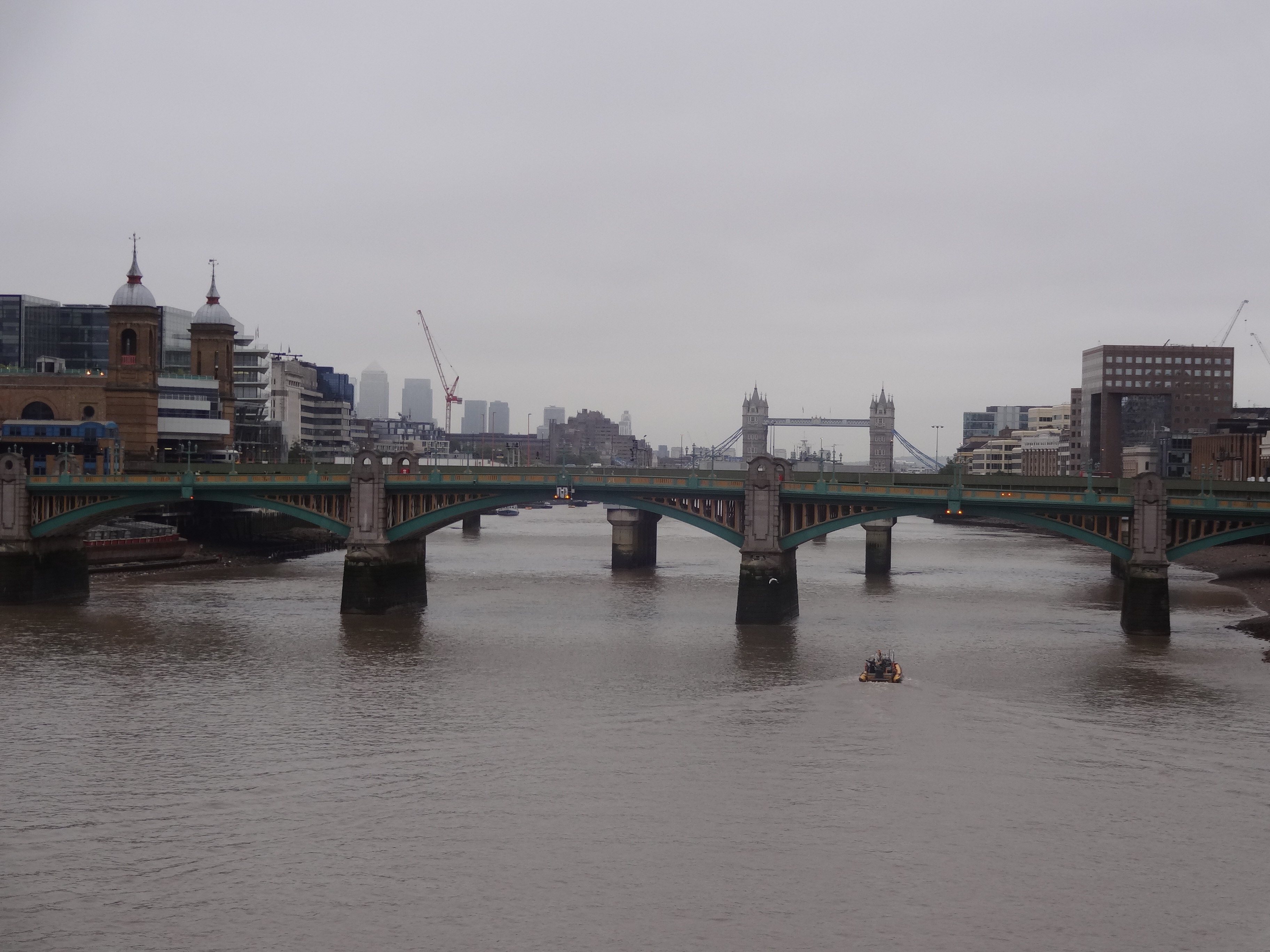
This day’s photo journal wouldn’t be complete without a picture of our penultimate destination – Tower Bridge – not to be confused with London Bridge our final stop on Day Two, and just a short half mile away.

Yay!  Tower Bridge!

Yay! Tower Bridge!

Thames Path: Day 1: Woolwich Arsenal to Greenwich


Woolwich Arsenal – Thames Barrier – Millenium Dome – Greenwich

I haven’t been on one of my beloved hiking trails this year, and the prospect of hiking in Nepal seems a long ways off right now…at least at the moment as we try and settle into our new lives.    In the middle of everything else this summer, I planned the possibility of starting a new UK trail, something I could do with family, in increments when I’m visiting. The Thames Path National Trail seemed perfect for that.  Its 180-200+ miles longs (depending on where you start) and follows the Thames from its source in Oxfordshire to the mouth of the river in London.  Also, almost half of it is easily accessible as a day trip from my family’s London home, which cuts down the cost and logistics.  So with only a few precious family days here and there to grab over the years….this seemed like a very doable journey…even if it takes us forever!DSC00498

File:London River Services map.svg

Day one of the walk started at Woolwich Arsenal, home to Arsenal Football Club and the historic Royal Arsenal on the South bank of the Thames.  At this point in the journey, the Thames Paths offers a choice of North or South Bank and, for various reasons, we chose to follow the South Bank path.  Choosing to do the path in reverse (most people do it from the source out to the sea) meant that we were starting in the least developed part of the Thames.  In fact, parts of the path were still being finished, and as London starts to move Eastward and develop the its far Eastern Boroughs, previously long neglected, we walked through much construction and development, abandoned industrial sites and spanking new luxury apartments.

Thames Path

It many places the walk is well signposted. If you thought that that signage for a route that follows the river isn’t really important, you’d be wrong. The Thames Path at this stage of the journey and this point in time is a area in flux. There were plenty of clues that the path was constantly being diverted as construction affected the banks of the Thames. Or sometimes long established riverside property meant that the path would turn inland for a while and the way through the industrial backroads wasn’t always clear. I wouldn’t always have felt safe doing this part of the journey alone.

Woolwich Market

Woolwich Market near the start of the walk

Royal Woolwich Arsenal

Nikki on a call amid a sculpture at the Royal Arsenal. Walking through the Arsenal was an interesting mix of history, military heritage and funky art!

Woolwich Pier

Near Woolwich Pier. London through barbed wire. A grey prickly start to a very long walk….

Woolwich

Woolwich Thames Path. Canary Wharf in the far distance

Woolwich Ferry

Watching the Woolwich Ferry load up and depart…

DSC00497

First major landmark of the walk here is the Thames Barrier…


DSC00495

…and in the distance the next landmark… The Millenium Dome

If you glance at the earlier green map, this section of the walk could be shortened considerably by crossing inland across the large bend in the river.  Of course, that would totally be against the rules!  But it is relevant because the bend causes distortions in the perceived location and distance of landmarks.  At the Thames Barrier, the Millennium Dome seemed closer than it did a few kilometers further along the river.  And once we approached the Dome, we seemed forever in its shadow.  It was perpetually just around the corner, upon us, or just behind us for what felt like most of the walk that day.

The Emirates Airline Cable Car

The Emirates Airline Cable Car across the Thames. A pretty new addition that I had no idea existed. Apparently originally designed as a commuter option for crossing the Thames, since the end of Olympic traffic use has dropped considerably. Most of the cars looked empty to us.

Canary Wharf

Canary Wharf

A second large loop in the Thames around the Isle of Dogs made for another windy detour towards our second omnipresent landmark:  Canary Wharf.  Canary Wharf is a new major financial district in London, its tall skyscrapers visible from a long way off. Like the Millenium Dome they stayed with us all day and into the nex,t until we were far along enough for even the tall towers to disappear.

The last stretch of the day was along a neglected strip of riverside towards Greenwich. It was run down, a little spooky, and full of reminders of an older industrial London port of times gone by.

boat

Nikki’s excellent photo of an old, creaky barge moored along that stretch of the river.

DSC00507

…and, yes, we had to walk along this stretch..under the arm of the bulldozer…after we got the ok from the driver. This stretch was definitely not quite ready for us!

Finally after this neglected section, we were suddenly in beautiful kept, historic Greenwich with its charming restored houses, quaint village pubs, historic sites and tourists. It was quite a change of scene.

DSC00509

The Royal Greenwich Observatory

Cutty Sark

At the Cutty Sark. Our last stop for the day


Devon Revisted


My blogging has slipped for the past month.  Its hardly because of lack of things to blog about, more that things have been crazy busy and I’ve been unable to catch up.  But here on the long Nepali holiday weekend, the rain has messed with our plans and I am at home with some time to do just that….catch up.

I’ve been back from the UK for two weeks now, have started a new job and unpacked the our many boxes in the attempt to make our new house into our new home.  But before we get to that post…a little back tracking….

Around the middle of September I managed to sneak a few days down in Devon to visit my friend Katie. Its been a long while since I visited both Katie and Devon. She recently bought a traditional Devon Longhouse “fixer upper opportunity” which, coincidentally, is in the same town where I was married, so it was wonderful to go down and see their new home and poke around the area where we honeymooned quite a few years ago now.  The house is vast and beautiful, and in need of lots of TLC but they are no strangers to fixing up period houses.  This one dates back about 400 years.  The traditional long shape comes from the ancient practice of combining human housing and animal stables into one long building, especially in the Winter.  Nowadays many have been fixed up into large country houses or converted just to barns.

DSC00466

The gorgeous new house which is a great deal larger than this picture suggests.

Devon Long House

Yup its the whole building…along with a “L-shaped” wing. Nine bedrooms altogether.

Devon Hedgerows

Bombing down Devon hedgerows

My memories of the area were like pieces of a jigsaw puzzle that hadn’t been fitted together. I remember the town where we rented a cottage, the little pub, the little church, and the narrow country lanes that connected it altogether.  And it was all still there, just like I remembered.  Charming and timeless.  The Drewe Arms was still there too.  Back in the Eighties the pub was run by a ninety-something old lady who put the money for your beer or cider into a little cash box.  There was no register – no bar either – and no service to speak of.  You helped just yourself to your drink from the wooden barrels lined up against the wall.  Today she has gone, of course, but I’m told the pub retains in original character. I would have liked to have sneaked a peek inside but unfortunately, we just didn’t have time to stop for a drink.

Drewsteighton Church

Drewsteighton Church

Drewe Arms, Drewsteighton

Drewe Arms, Drewsteighton

Drewsteighton Church

The beautiful, peaceful church yard. We walked around it many times in the cold of the Winter.

Devon Farmland

Catching a glimpse of the farmland between gaps in the hedgerows

For me, the visit wouldn’t have been completed without a visit to Dartmoor.  I’ve rarely been there in the Summer, usually visiting in the depths of Winter, when it can be incredibly cold, exposed and can freeze your face right off.  But I do have a thing for moors in general.  I love their wildness but I fear them too.  On Dartmoor you can ride right through them by car and on a sunny September day with no rolling fog, there was just scenery and sheep to enjoy.

Dartmoor

A fleeting glimpse of Dartmoor from the car. Must add the “Two Moors Way” to my hiking itinerary!

Dartmoor

Its only when I come back to England that I remember how much sheep are a part of the countryside. Katie has over 200 of them on 100+ acres of land and I barely had time to get out and meet them. But I loved my short visit and seeing their new home and I thought about the prospect of returning to my new home in Kathmandu. A lovely corner of the world.

Devon Sheep

A couple of Katie’s beloved “Bluefaced Leicesters”!

DSC00485

My favourite corner of the farm….the vegetable garden. Past its best in late September, it was still producing late Summer vegetables. Beautiful loam and a beautiful view. I wish I had one of these in Kathmandu!


Day 4: The Ridgeway: Wantage to Goring


Lockridge Farm was the best start to a new day that we had experienced yet.  The exit out the B&B took us immediately to a footpath and then straight on the trail.  No back pedaling, no rain, and no road walking.  The farm is located at the highest point in the local vicinity, so we headed out to more flat ridge walking and the occasional cyclist or jogger out and about on a Sunday morning.

The trail had few other walkers on it the whole time.  Its not as popular as the other long distance trails that I’ve walked, but today was Sunday and we did see a few family day walkers and dad’s out exercising with baby carriers or dogwalkers.

We did fourteen miles today, and most of it was level or down hill.  The few climbs we had were gentle and not very long.  We covered most of it quite quickly in about 5 hours, slowing down only near the end as the road walking started.  Crossing the river from Streatly into Goring, we entered West Berkshire(our third county in four days) and into the world of Sunday afternoon cream teas and day trippers out to enjoy the sun.

A beautiful four day trip.  Nikki was a great walker and we were really lucky with the weather.  48 miles.  DONE!

Day 3: The Ridgeway: Uffington to Wantage


The morning of the third day began with a steepish climb back up Uffington Hill, back to the White Horse and on to the continuation of the Ridgeway trail.  Only six miles today of trail walking, plus a couple of extra miles into Wantage, a small town off the Ridgeway proper.

The walking was pretty easy.  No real ascents or descent after the initial climb, just long stretches of ridge walking – it is called The Ridgeway after all.  Here’s a view of a typical stretch of trail.

It was dry but windy on the trail, and I was feeling a little too windswept today.  The scarf on my head became my new best friend as I tried to the hair out my face.  I got a bit tired of seeing pictures of myself with the thing on my head, but it did keep me sane.

Breaking up the miles of grassy trails, there were another couple of hill forts today, but we decided to keep going.  Pretty though they are, after a while its seen one, seen ‘em all…..

We took a nice long break at the Court Hill Tearooms not far from the end of today’s section.  We made tea and a cake last at least an hour as we took a break from the windy weather.

Of course, the last couple of miles into Wantage were along the road.  There’s some dangerous verge-less strips of road where there’s nowhere safe to stand away from the racing traffic, so we trespassed by taking a safer side route through some farm fields.

Wantage was upon us quickly, though.  It’s a pretty town with shops and restaurants, which came as quite a shock after a few days in villages.  We arrived at around 3pm and decided to stay there for dinner, before taking a taxi out to the B&B farmhouse where we were staying that evening.  After a coffee break, we took a little walk around the town, looking at the small, attractive houses, shops and church.

Around the churchyard


After a yummy Thai dinner at Yummy Thai Food, (yes, it really was!) we headed out to Lockridge Farm B&B by taxi.  No, it wasn’t cheating.  We were off the trail already!  Good stay, early night, and the last and longest day tomorrow….

Day 2: The Ridgeway: Ogbourne St George to Uffington


We woke up to our first rain in the morning.  The weather forecasters were promising brighter spells later in the day, but to start off we needed to don our raingear and head out the door regardless.  Again, we took a slightly different route than the Ridgeway for a short while in the morning, joining the trail a little north of the village.  Again, this meant some road walking but this time on a busier A road in the rain.  The cars whipped by the narrow grass verges where we stood for some protection, and I was glad to reach the Ridgeway trail again after about a mile.  The weather started to brighten and we saw the sun start to come out.  Our walk today was 12 miles with two highlights:  Waylands Smithy, another ancient long barrow, and the White Horse of Uffington, an ancient hill carving.

The view from the ridge in the light rain

There was lots of ground to cover across country lanes and wide grassy tracks.  I loved the wheat fields, splashes of poppies, bright rapeseed fields, and other crops growing around us.  We continued to spot different breeds of cows and sheep, as well as today’s animal highlight, horses, Lots of them.  Unlike the pea-brained sheep, when they saw us coming they all ran to the fence to greet us and watch us with an intelligent curiosity.  I wish I had been able to capture the sight as about 30 horses galloped together to the edge of the field.  Here’s my best effort with just a camera:

A field full of horses came over to greet us

Horses were an important theme of this trip.  Race horses feature prominently in the area.  Grassy circuits called “horse gallops” appeared alongside the trail regularly.  We hoped to catch a glimpse of them in training, but with no luck.  I think we were always too late in the day.  However, we did see them grazing in the fields, and being ridden around on the many bridleways that crossed our path.  And of course, there was the horse, the White Horse of Uffington, waiting to greet us at the end of the trail.

Sitting near the eye of the white horse looking down the valley

You can’t see the White Horse when you are on it, just swoops of bare chalk where the image has been carved.  Here’s a view of it from a distance away:

An explanation of the day wouldn’t be complete without a more detailed mention of Wayland’s Smithy, another extraordinary long barrow tucked away down a country lane.  Unlike the West Kennett Long Barrow we visited a couple of days earlier, we arrived in the afternoon as the sun made a re-appearance and everything seemed so much less spooky.

At the entrance to Wayland’s Smithy

In fact, Nikki managed to get a signal on her phone, and while she caught up on texts, I lay in the damp grass and closed my eyes.

Chillin’ at the barrow

I even managed to get a power nap.  We stayed at least half an hour in that quiet, hidden place until other visitors showed up and the spell was broken.

We spent the night at Norton House in Uffington Village, after about 1.5 miles of road walking to end our day.  A sore finish for the knees was starting to be a regular occurance.  Uffington Village is in Oxfordshire, somewhere today we crossed the border into the next county, and very pretty it is too.

There were lots of chocolate box thatched cottages and pretty English country gardens.  We had a pretty good dinner in The Fox and Hounds, except for the gritty side salad which really let them down.  A shorter day tomorrow – only six miles – almost a day off!